VisualPAMS Pro Integration
Seamless integration with the Visual PAMSPro™ database for accurate parcel data.

New for Township Assessors
Clarity is proud to introduce our latest solution for Township Assessors: Comparable Mapping Software.
This powerful tool enables Assessors to quickly generate professional maps for appeal packets, displaying all comparable property types with ease.
Simplify the appeals process and enhance the presentation of comparable property data with Clarity’s Comparable Mapping Software.
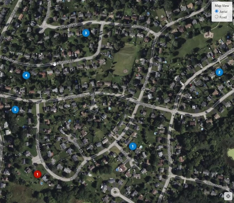
Everything you need to build compelling, print-ready appeal packet maps.
Seamless integration with the Visual PAMSPro™ database for accurate parcel data.
Automatically generates custom maps based on parcel information.
Creates maps showing the subject property and comparable properties.
Print professional maps ready for inclusion in the Assessor’s appeal packet.
Watch how Comparable Mapping Software extracts data and generates a print ready document for inclusion in the Assessor’s appeal packet.
Seamless Integration
Comparable Mapping Software connects directly to your Visual PAMSPro™ database, pulling parcel information automatically so you can focus on preparing strong appeal presentations—not manual map assembly.
Let’s talk today about bringing Comparable Mapping Software to your office.